Sunday 28 October 2018

Takasuzan 高祖山 Hiking 2018.10.28

Takasuzan 高祖山 Hiking 2018.10.28

Takasuzan is one of the mountains in the Itoshima region of Fukuoka. It is a short hike, only lasting around 3 or so hours which makes it ideal if you want to hike some but not spend all day doing it. The mountain was once home to a large castle and there are plenty of ruins and earthworks around the area which you can find. My hike ended with the Takasu shrine which is a beautiful shrine at the base of the mountain. I would suggest that you do this hike in the reverse fashion to how it has been displayed here. There is car parking near the shrine, toilets and a map box with free Takusuzan hiking maps and there is even a local convenience store by the road. 

Access: Take the train to Susenji 周船寺駅 station using the Kuko subway line to Meinohama that then changes line to get to Itoshima. There is a local bus service that runs down the main road next to the mountain it has a flat rate of 200 Yen which you need to pay in cash when you get on the bus. The timetable can be found here Taksuzan Bus Time table the main local city site is here Itoshima city. I started the hike at the Koraiji 高来寺 bus stop however I suggest you stay on the bus for a few more stops and get off at 高祖 Takasu and walk up to the Takasu shrine 高祖神社 parking area and start from there. 
A scan of the map made by the local city. Paper copies are free. 
To get to the bus stop I had to leave the station and turn left at the river. The bus stop was easy to find. 


The Itoshima local bus service
An information board just down from the Koraji bus stop. It has English and explains some of the history of the area
Oitmatsu Shrine 老松神社 a pretty little local shrine


The entrance to the trail is a little way back up the road towards the station. The steps go up into the forest and there is plenty of signage in English and Japanese. 


The first of many sites where you can still see the foundations of some ancient buildings. Most of these were the previous sites of watch towers or other buildings connected to the main castle which was on the summit. Along the hiking route there were plenty short diversions which were around 20 to 50 meters from the main trail and well worth checking out. 


There were plenty of rest points with benches. The summit is not far from this point. The downward journey I took is to the right of the photo. I headed to the summit to take in the view and the history before descending from here. 


The summit sign. There was a mapbox right next to the sign. A strange place to put it I thought considering this would be the end of the most peoples hike. 

The summit was also the main site for the castle which was used for defence but also as a residence. 

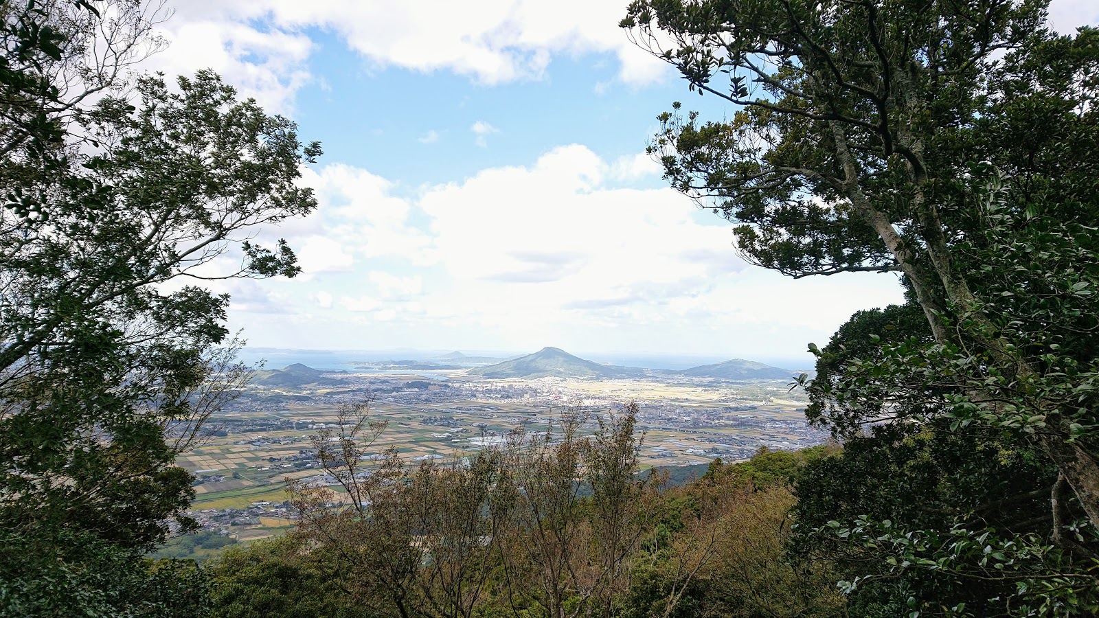
The view from the summit was not the most amazing. But it did give a good look at the coast and Kayasan in the distance. 

The view from the other side of the mountain. 


The sun finally came out!


The route down was pretty and in places steep and challenging. It headed down to an old road which goes straight to the Takasu Shrine. 


The Takasu shrine is a fairly large shrine. There were a number of buildings connected to it. The pictures and art in the shrine itself was interesting to look at


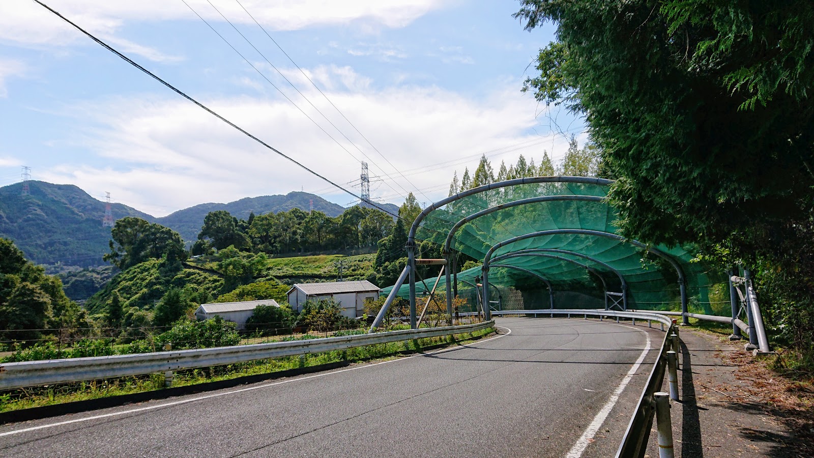
The final part of the hike near the main road. Taksuan can be seen in the background. 


I missed the bus and because I ended the hike far from the station it meant a walk of around 50 mins to get back. Not the end of the world but another reason why it would be better to start from that point and end the hike closer to the station. 

I looked back over the fields of Cosmos flowers at Takusuzan in the distance.  A good hike that left with plenty of the day left to relax. 

The full photo album can be viewed here Takasuzan Photo Album

Wednesday 24 October 2018

Tenpaizan 天拝山, Kizan 基山 and Amandi Spa 筑紫野温泉アマンディ 2018.10.21

Tenpaizan 天拝山, Kizan 基山 and Amandi Spa 筑紫野温泉アマンディ 2018.10.21

This is one of the most accessible and varied hikes that is also close to Fukuoka city. The first part of the hike is simple and you should visit the previous posts on Tenpaizan, the second part is Kizan (Kiyama) however using this route you will come from the back of the mountain and go down the way in my first guide found here (With an unintended and shocking twist) This isn't a tough hike however it is long at around 12 km and it could be longer depending on what diversions and paths you take. 


This is a capture of my hike. The light blue line is the hiking route I took. 

Part one: Tenpaizan 


The first task is to follow the main route up to the summit of Mt. Tenpai. I drank in the views and took a short rest year. I also snapped some newer pictures of the two main shrines the summit shrine and the "cat" shrine as my kids affectionately call it, about half way up. 
Cat Shrine - Named for all of the cats than roam around it

 
Summit shrine

Part two: Descending Tenpaizan, Lake Tempaiko


To find the route to Kiyama (Kizan) you need to go behind the viewing platform and find the route which goes of sharply to the right. It is a steepish decent. Soon I came across this signpost. Taking the trail right leads to the bottom of tenpaizan, but straight ahead goes to Kiyama and the Tenpaiko lake. 
There are plenty more steps on this route. 
This route has a lot less foot traffic


Eventually the trees started to change until the forest became a dense bamboo forest. A wonderful peaceful atmosphere. 

The bamboo forest eventually changed back as I got nearer to the lake area and the base of the mountain. 

Our route is left. Straight ahead goes to Ushikubiyama


Eventually the path widens and I could hear the sound of running water. The trail now sticks closely to a stream heading to lake Tenpaiko. 


The old road leading to Tenpaizan. From here I emerged from the forest and soon after the lake came into view. 
The next stop was to head to the Otani Forest road. Luckily the signposts were still in english as well. 
Lake Tenpaiko. It also acts as a reservoir for the area. 


Part three: The Otani Forest Road, Kiyama (Kizan) 


I kept following the roads around looking out for the Kyushu Nature trail signposting. When I came to this signpost I turned right to follow it and soon came to some more signposting. By this point I was the only one following this trail from what I could see. The peace was refreshing from how busy Tenpaizan was. 
The start of the Otani forest road is through here. The trail is real hiking with a far more challenging a rocky terrain than tenpaizan. This gate also says that the route is currently closed for hiking. The gate can easy be opened and I had come so far so I ignored the sign posts and ventured on. There was some rain damage but just some felled tree trunks to climb over and one to climb under. 


After emerging from the forest trail I came to the treeless summit of Kiyama (Kizan). This is a wonderful mountain and you can even drive to the top to take in the views. There were families having picnics and a lively but not over crowded feel to it. 


The views from the summit are quite fantastic. The mountain was once home to an ancient castle so like Shioji and Tenpaizan it has a lot of historical significance. 
Summit Shrine


 I took a break at the top near the viewing tower. Cooked up some noodles on my gas hob and made some coffee. 

After this is was time to descent. Near the bottom is a very historically important site. The remains of a water gate and castle walls. However I was soon in for a sad surprise. 
Part four: Descent of Kiyama, The water gate, to Amandi Onsen/Spa

Walking past the viewing tower I started the descent of Mt. Kiyama. Basically you need to follow the course on the sign below until you come to some steps that go quickly down. This leads to a tarmac road and the exit of the forest. 


A map board. This marks the end/start of the forest path. An old road connects/connected to it. 


As I progressed down the road the reason for the forest path being closed started to become quite clear. In the June time rainy season of 2018 (Just a few weeks after my last visit to Kizan!) heavy rain did a lot of damage and caused many landslides in the surrounding area. I attempted Ushikubiyama and had to abandon the hike due to safety concerns. Unfortunately Kiyama has also been very badly affected by this. Even doing almost irreparable damage to one of Kiyama's most important historical sites. 


Trees and debris litter the road

In places the road has been completely swallowed by the damage

One of my biggest gasp moments came looking back at the trail this was completely forested in early June. 
Taken in the same area in early June 2018


This is the site of the ancient castle wall and water gate. The main foundations and wall survive as they have done for over a thousand years. The bridge and Torii gate have been completely devastated. 

I met a local historian who has also surveying the site. He explained the importance of the site and told me that it is an historical treasure. As we were talking I saw an animal near the wall. A first he thought it was a wild boar but I noticed it was something very different. It was an Anaguma Japanese Badger. I crossed the bridge carefully and tried to get close to it. I was expecting it to run but it didn't seem to mind me at all and I managed to get within two metres of it. 
Japanese Badger. Anaguma

The watergate. The Torii gate has gone 基肄城 水門址
The back entrance near the main road to the Amandi Onsen/Spa
I left the mountain area and said goodbye to the historian. It was a shame to see so much damage had been inflicted on Kiyama however the main parts remain so I hope that the Kiyama local government will pay for the area to be tidied and repairs made to make the site more accessible again. It was great to nature continue with complete indifference, "the power of nature" the historian commented before we parted ways. 
From the mountain I took the road left and headed towards Keyakidai station. Then changed path and headed to the Amandi Onsen/Spa. It was a lovely public bath with many types of bath including a large Jacuzzi. You pay as you leave the onsen and it was quite pricey at 970 Yen for a weekend visit.  Check out their site here Amandi Spa


One final piece of luck. The Spa runs a free bus service from and to JR Haruda station. I managed to get the last bus at 4:30pm. 

Overall the hike was pretty amazing and had an incredible amount of variety in history, nature, terrain. The hike is definitely still doable but come prepared to navigate through the damage. 

You can view the full photo album here;